Weather forecasts... So important on a long trek, and so often contradictory or plain wrong. Sadly today was not one of those days - the evil predictions all came true.
Strange to think that only a week ago the forecast for this entire week was for sunshine all along my route, but happily I didn't trust it.
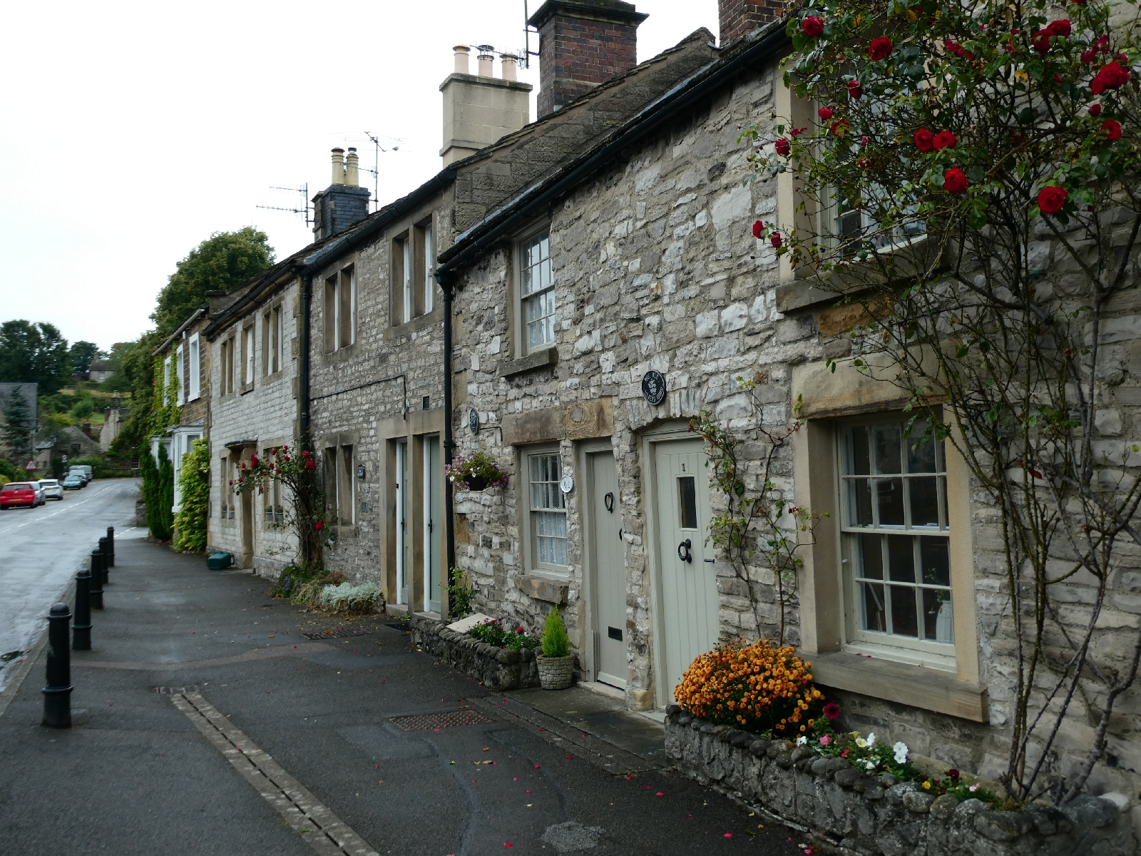
When I left Bakewell this morning it was grey, misty and drizzling, and quite chilly. I kept full waterproof gear on for the first couple of miles to Ashford-in-the-Water, an attractive village straddling the River Wye - the Derbyshire one, not the river of the same name in Wales.

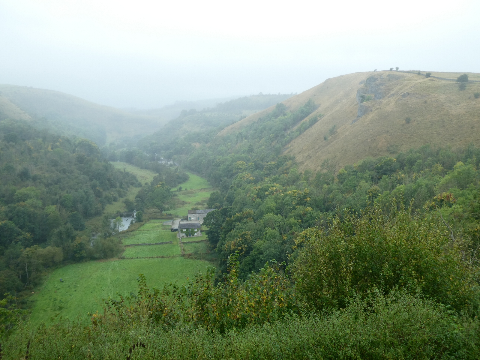
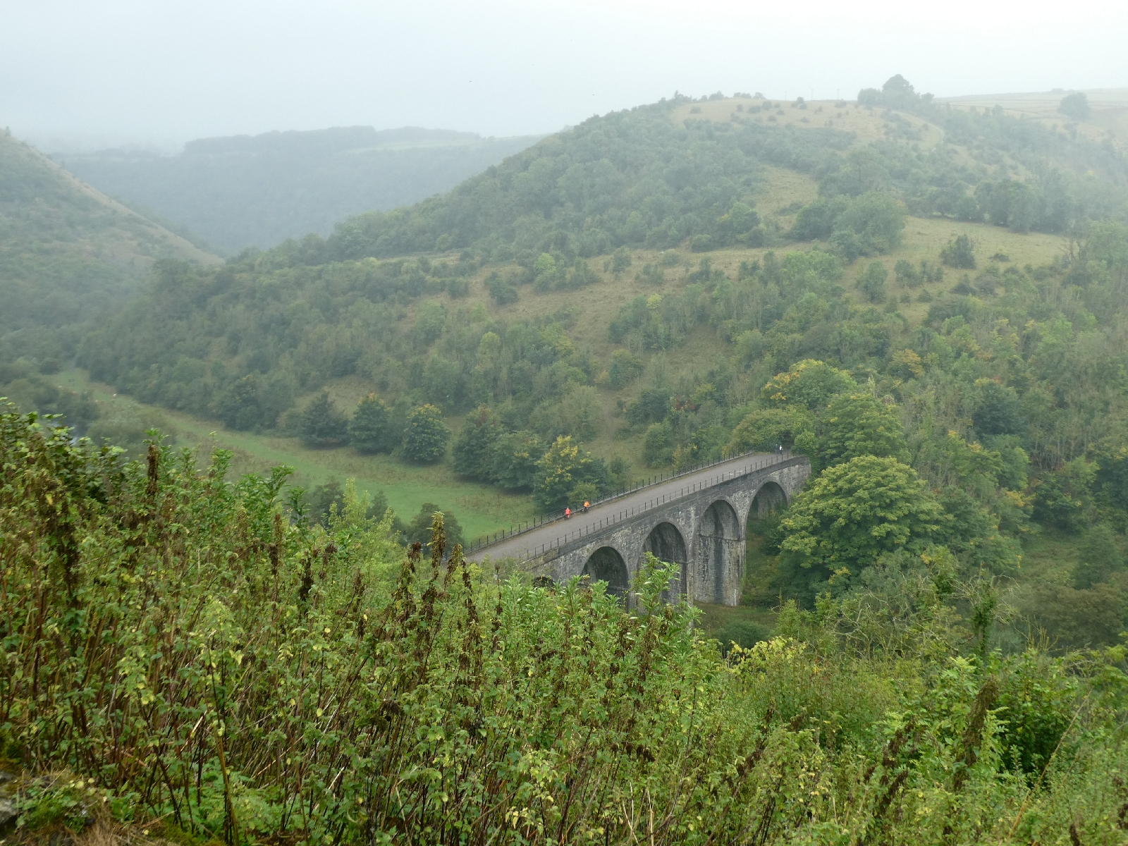
Things improved marginally on the climb up to Monsal Head, except for the mist. Monsal Head is a renowned viewpoint, looking down into Monsal Dale and the old railway viaduct which now forms part of the Monsal Trail, a walking and cycling route. It was all there, just very murky.
The greyness did not do much for the landmark Monsal Head hotel either, which looked like it could use at least a lick of paint.

I descended into the dale and followed the little road to Cressbrook Mill.
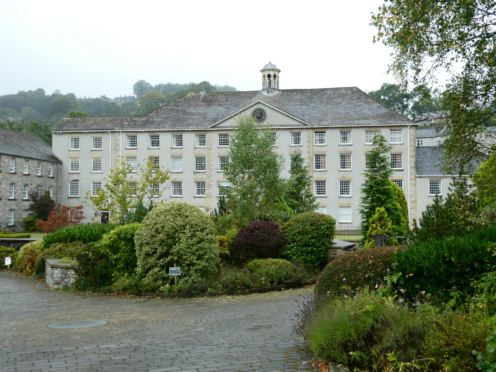
Cressbrook did not exist before 1762, then grew up around the cotton mill built originally by Richard Arkwright and later extended by McConnell. When the mill workforce objected to the quality of the housing, McConnell took it upon himself to build a model village, which today extends from the mill up a long and steep hill to the village centre and church at the top.
The mill went bust in 1965 and was falling into dereliction before being converted to apartments and posh holiday homes in the 2000s.
I climbed that long and relentless hill and rested by the little church, then putting waterproofs back on as the drizzle grew heavier.

I had abandoned plans to walk the length of Cressbrook Dale, partly because I wouldn't have seen much of it, partly because I didn't fancy almost three miles of wet slippery stony paths. Instead I followed a little road which crossed the tops to Litton. If only the weather had been better the views would have been really fine.


Litton is a neat village with a small green and a shop.

Another mile brought me to Tideswell, a large village dominated by a grand church, dedicated to St John the Baptist and nicknamed the "Cathedral of the Peak".


I sat to eat my lunch, fascinated by the way people seemed to dump their cars anywhere and head off to shop - it's not like that in London!
Just north of Tideswell, and another change of plan to avoid miles of field paths, I joined a little lane hopefully signposted "Castleton", still almost six miles away.
On this road things got a little serious. The drizzle intensified and the wind was quite vicious - it felt like late October, not the start of September.

The road eventually sets off in a long curved diversion around the edge of an enormous limestone quarry, the road is narrow but obviously quite new. The old direct line of the road is still discernible on the map. Here also the road rises, going up to over 1,300 feet, actually the highest point of my route so far. But I could see nothing of it. It was above today's very low cloud line, and for around 1½ miles visibility was less than 50 yards. I was passed by only one car. The experience of being up there alone in the mist was quite unusual.

As the road descended suddenly Castleton village came into view, as did the Hope cement works, an unfortunate Peak District landmark for decades.


Castleton is the classic Peakland hub, with more pubs per yard than most places I know, outdoor shops, and an abundance of grey stone.


Tomorrow is forecast to be quite different - sunny and warmer. But that's only a forecast.
No comments:
Post a Comment