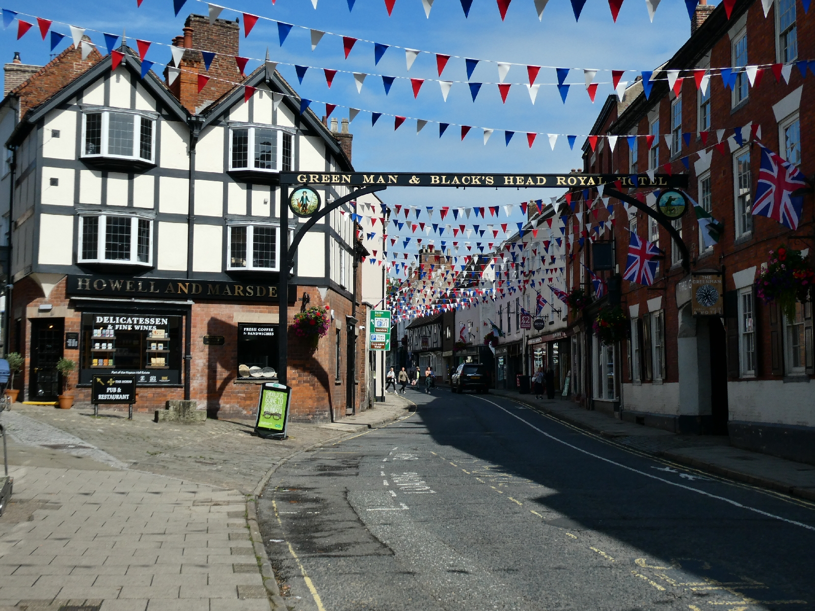
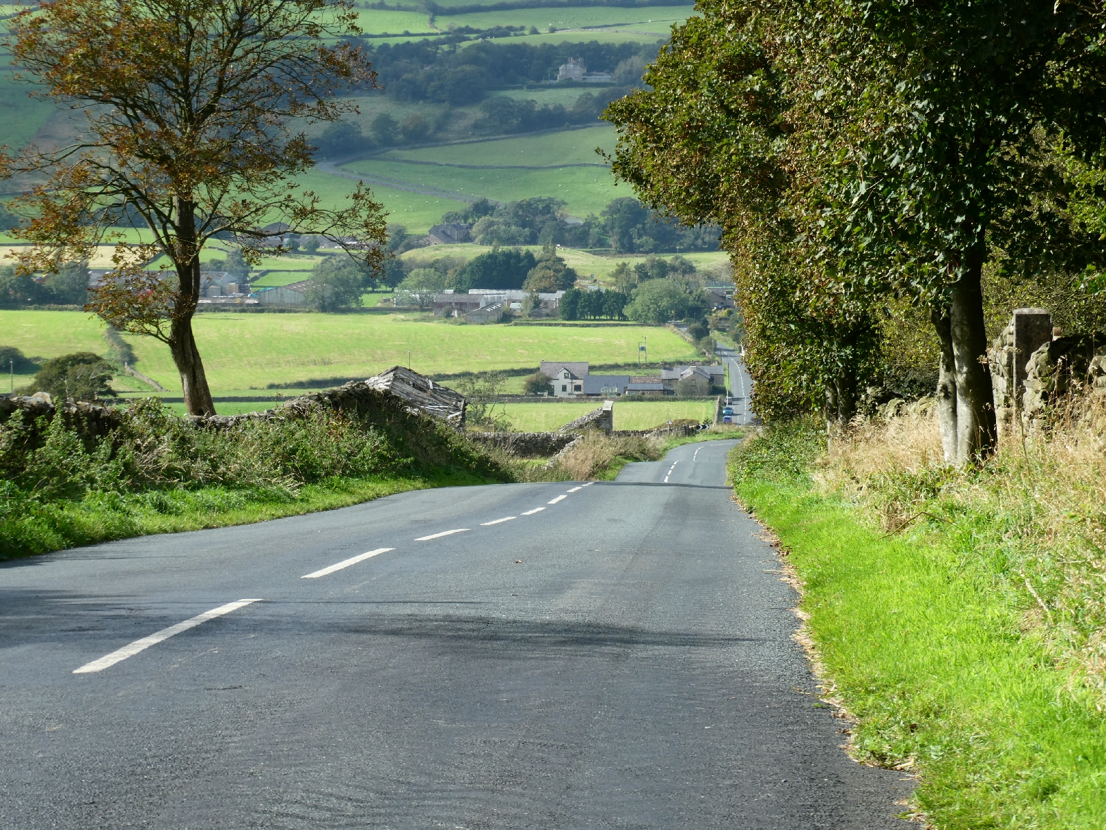
Day one - Sunday 1st September - Lichfield
Another trip begins, once again in a city away from home.
After a very crowded train journey from London and a mile or so if
walking from the station I find myself in the centre of Lichfield, in
Staffordshire, twenty miles or so north east-ish from Birmingham.
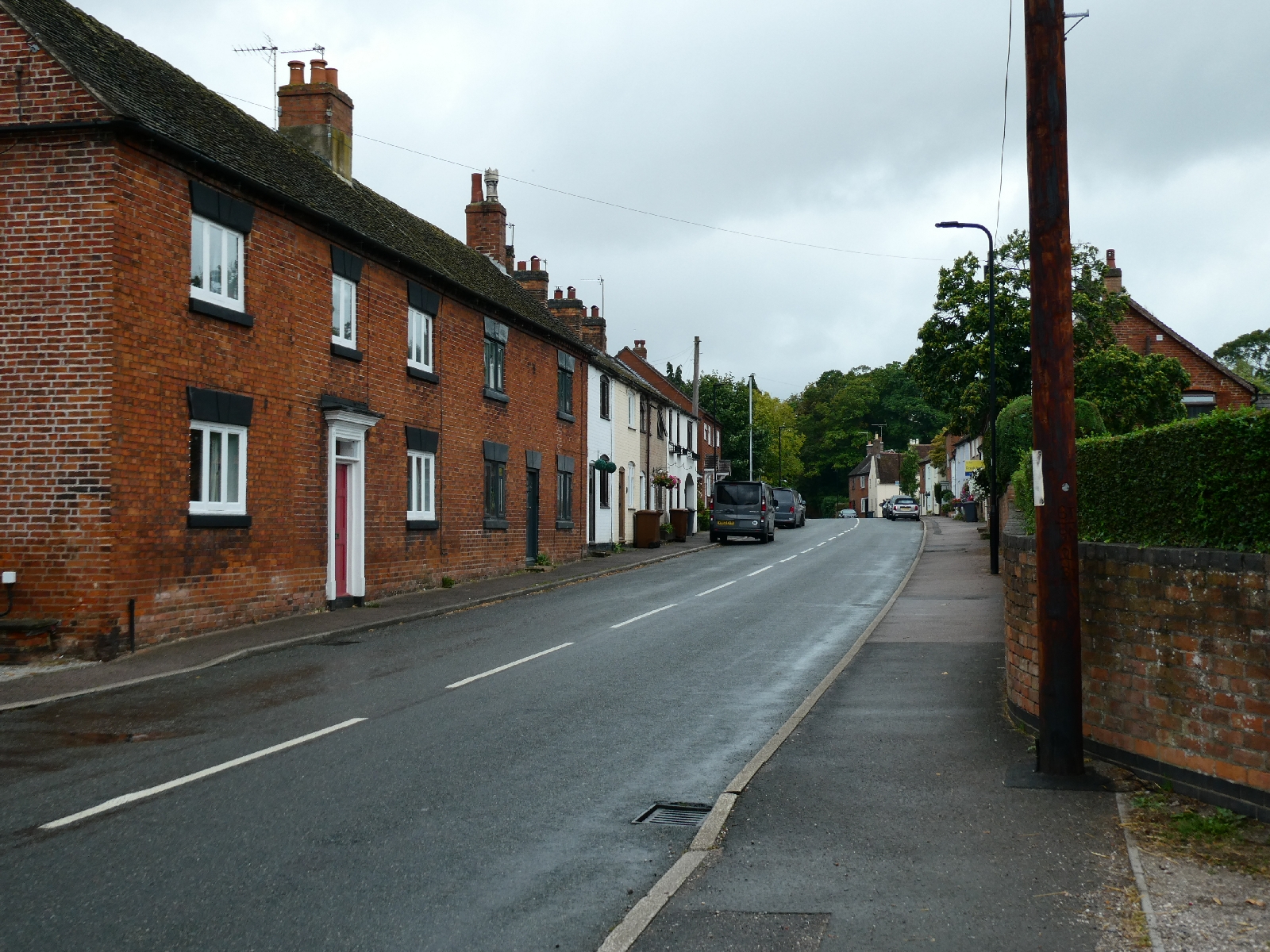
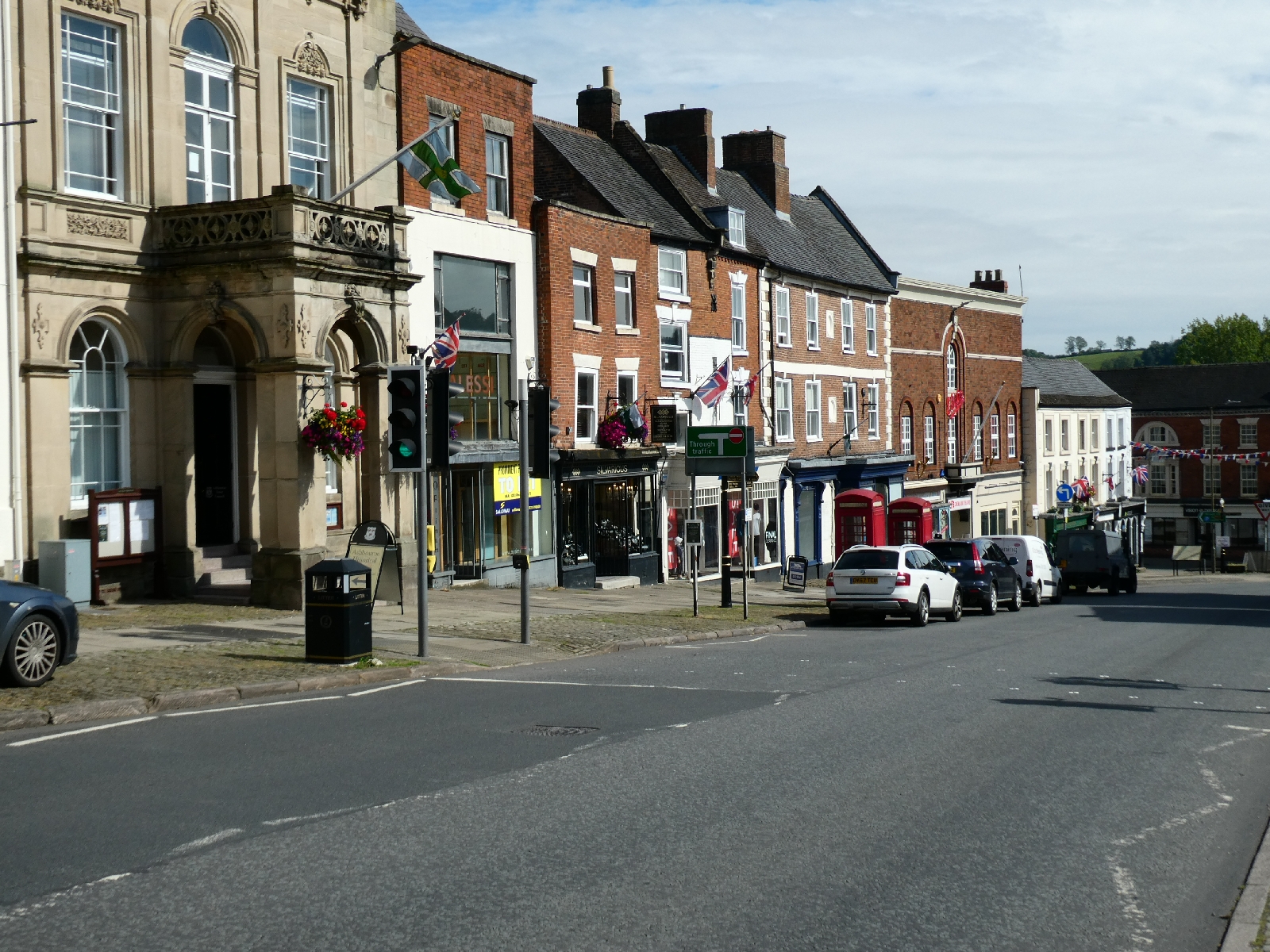
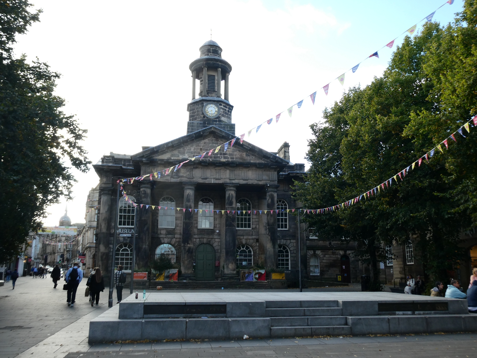
It's a compact city, just 35,000 souls, with a pedestrianised centre and lots of Georgian red brick mixed with older styles.


Dominating it is the only mediaeval cathedral in the country to have three spires, built in local red sandstone (there are two others with three spires in Truro and Edinburgh, both Victorian).


It
was impressive even before 19th century restoration of the main west
façade, the hand of George Gilbert Scott having added numerous statues
and decorations in the original material.
A service was in progress while I visited this afternoon, so only part
of the interior could be explored and photography would have been
inappropriate.
The city's other claim to fame is as the birthplace of Samuel Johnson, in 1709, celebrated in a small museum (closed by the time I reached it. It's Sunday).
The forecast thunderstorms have not spoiled the afternoon, no doubt
they're waiting for me to start the walk for real tomorrow. The first
day is planned as a gentle introduction, with little drama in the
landscape, and is due to take me about 18 miles north, to Tutbury. The
hotel there has just taken prepayment, which adds an incentive!


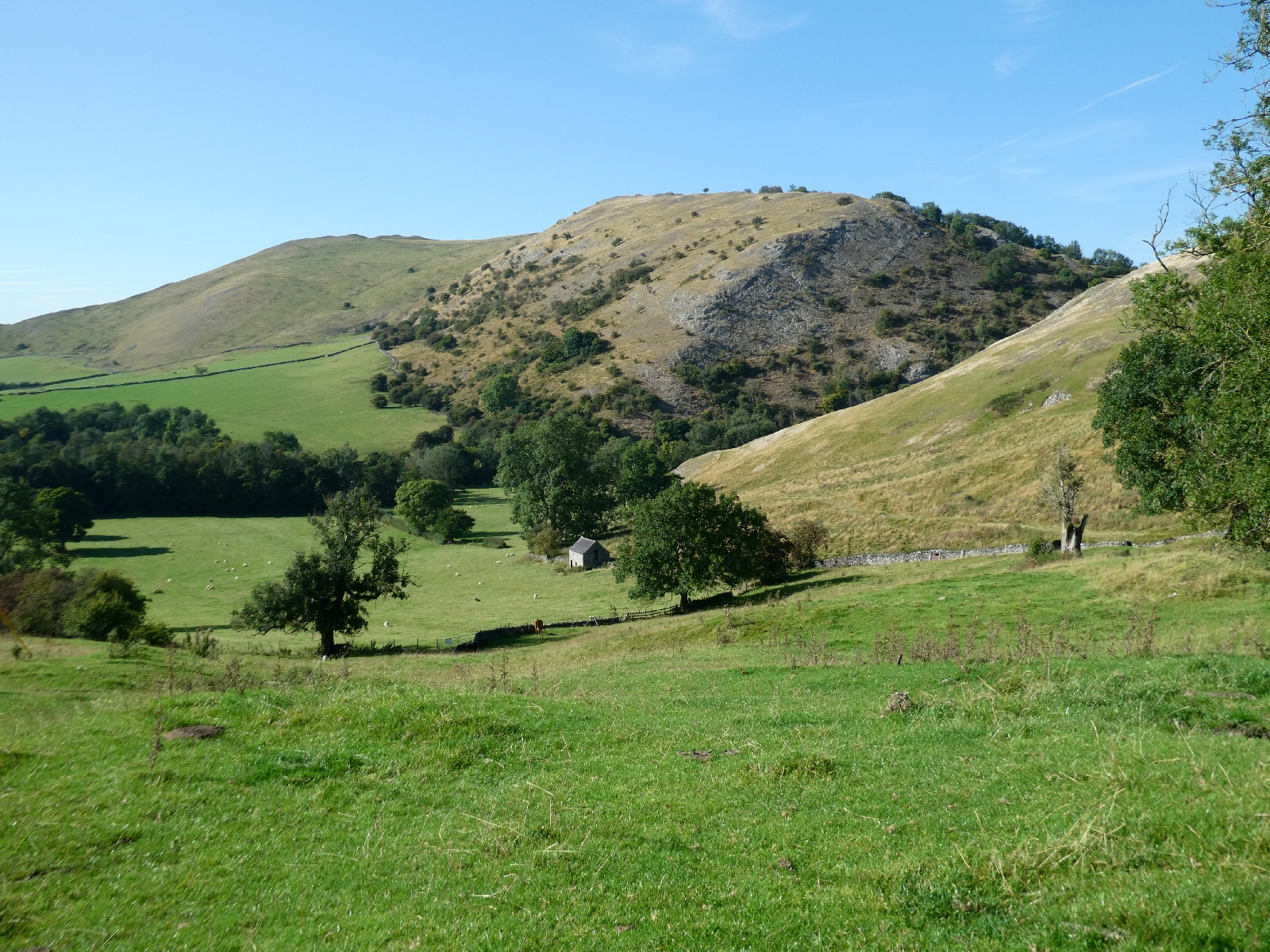
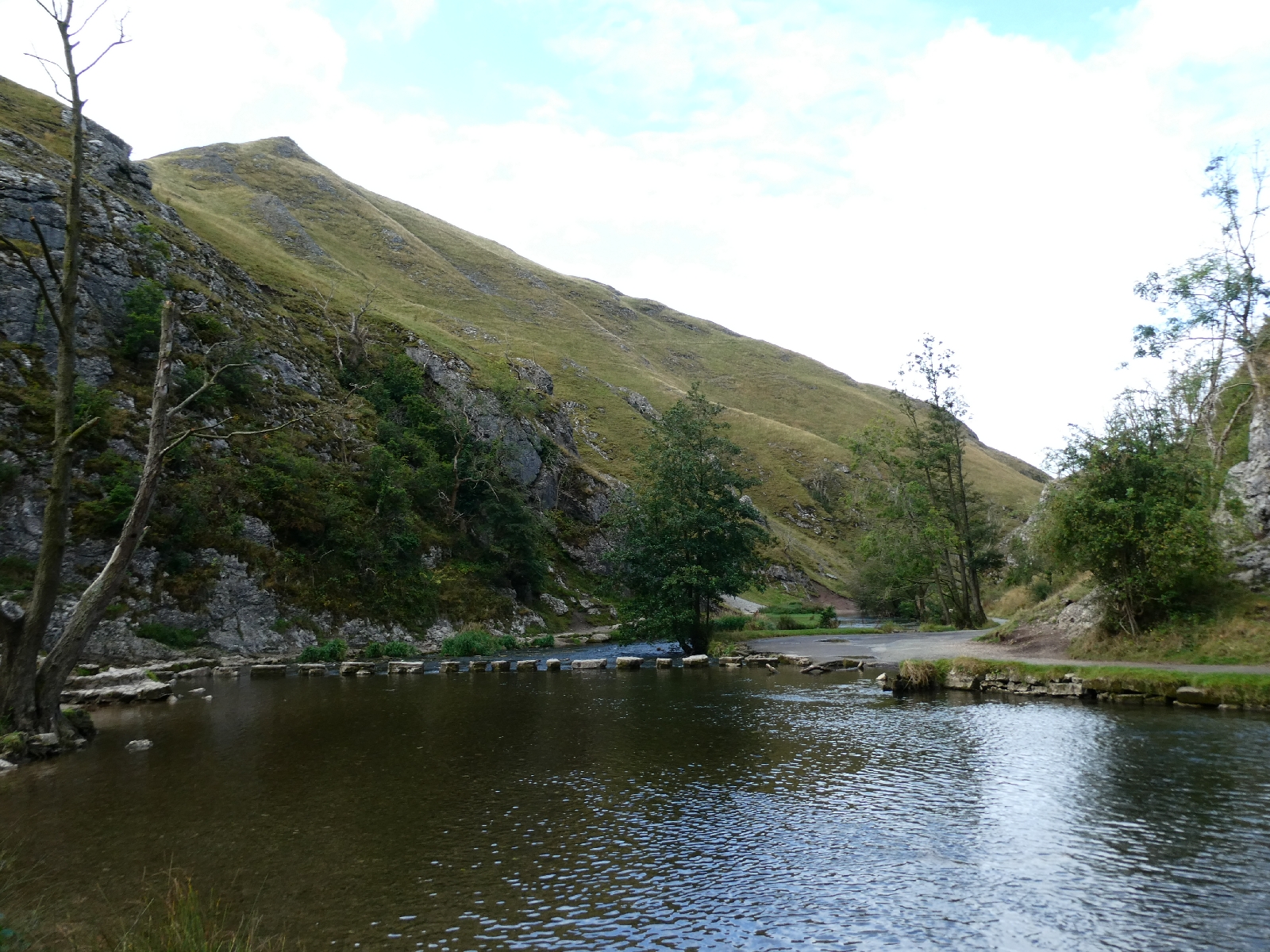
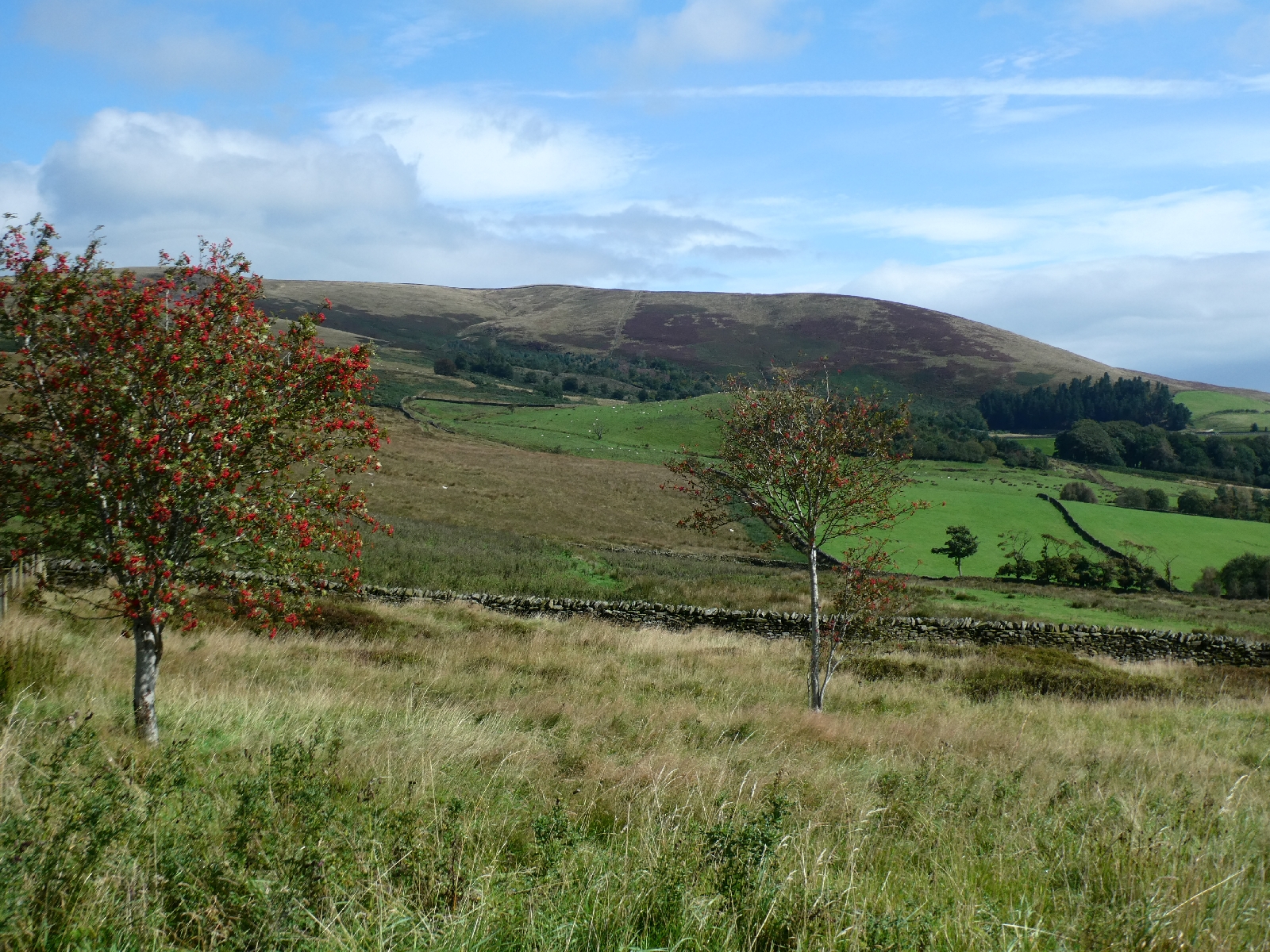
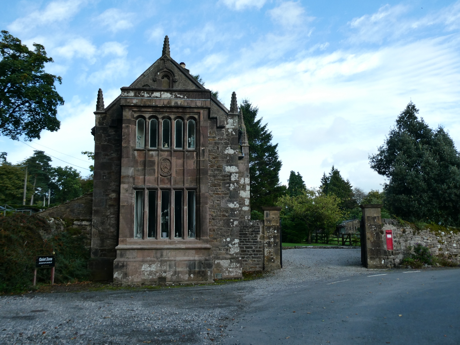
Day Four - Wednesday 4th September - Ilam to Bakewell

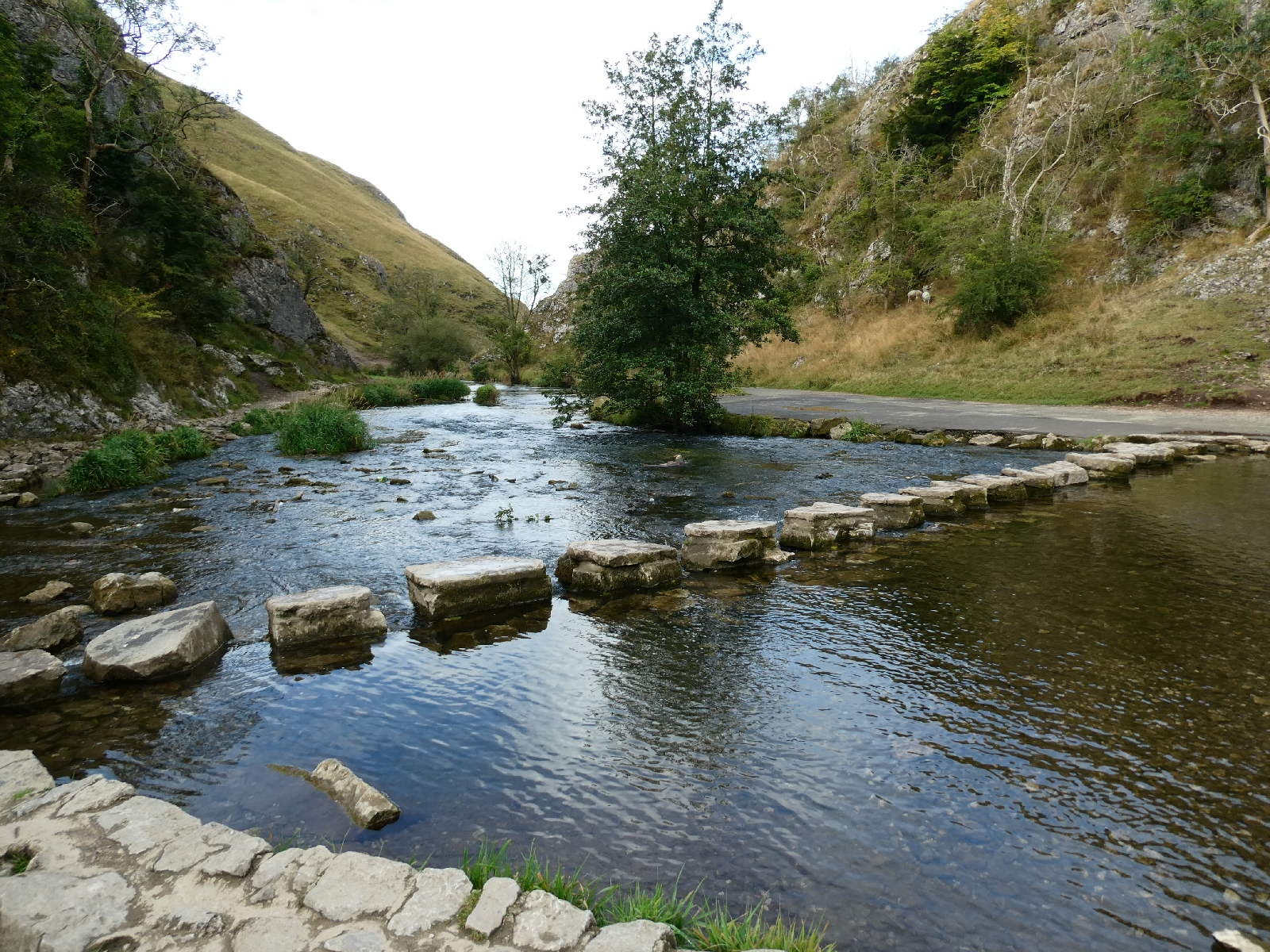


Day Five - Thursday 5th September - Bakewell to Castleton
Weather forecasts... So important on a long trek, and so
often contradictory or plain wrong. Sadly today was not one of those
days - the evil predictions all came true.
Strange to think that only a week ago the forecast for this entire week
was for sunshine all along my route, but happily I didn't trust it.
When I left Bakewell this morning it was grey, misty and drizzling, and
quite chilly. I kept full waterproof gear on for the first couple of
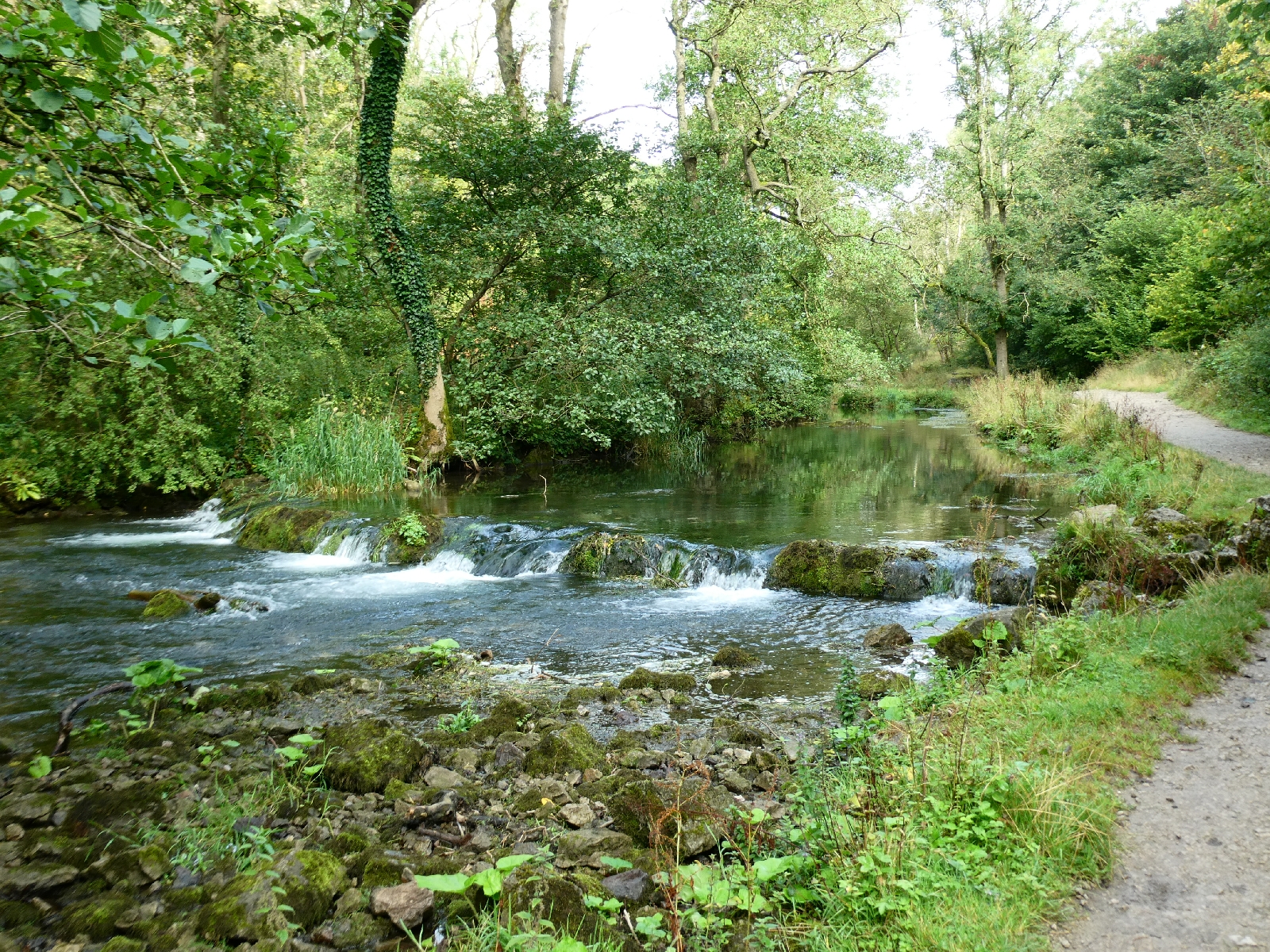
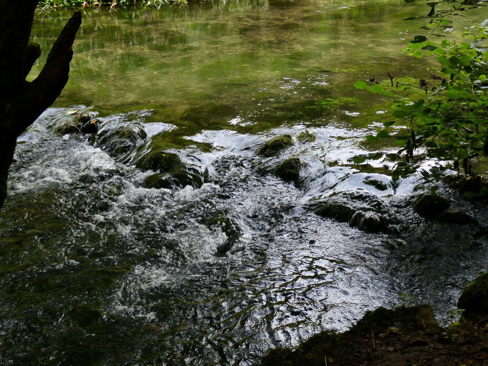
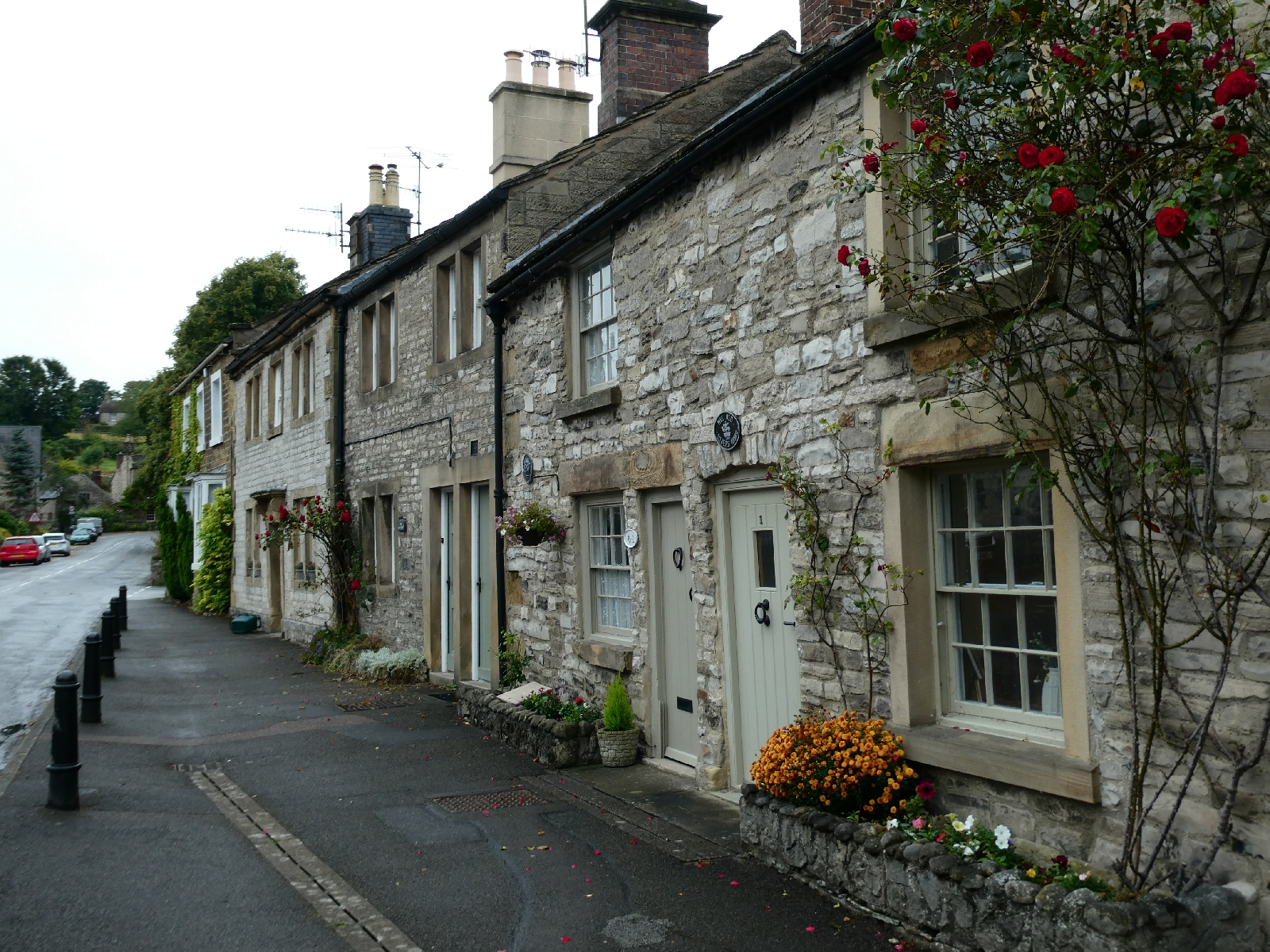
miles to Ashford-in-the-Water, an attractive village straddling the
River Wye - the Derbyshire one, not the river of the same name in Wales.

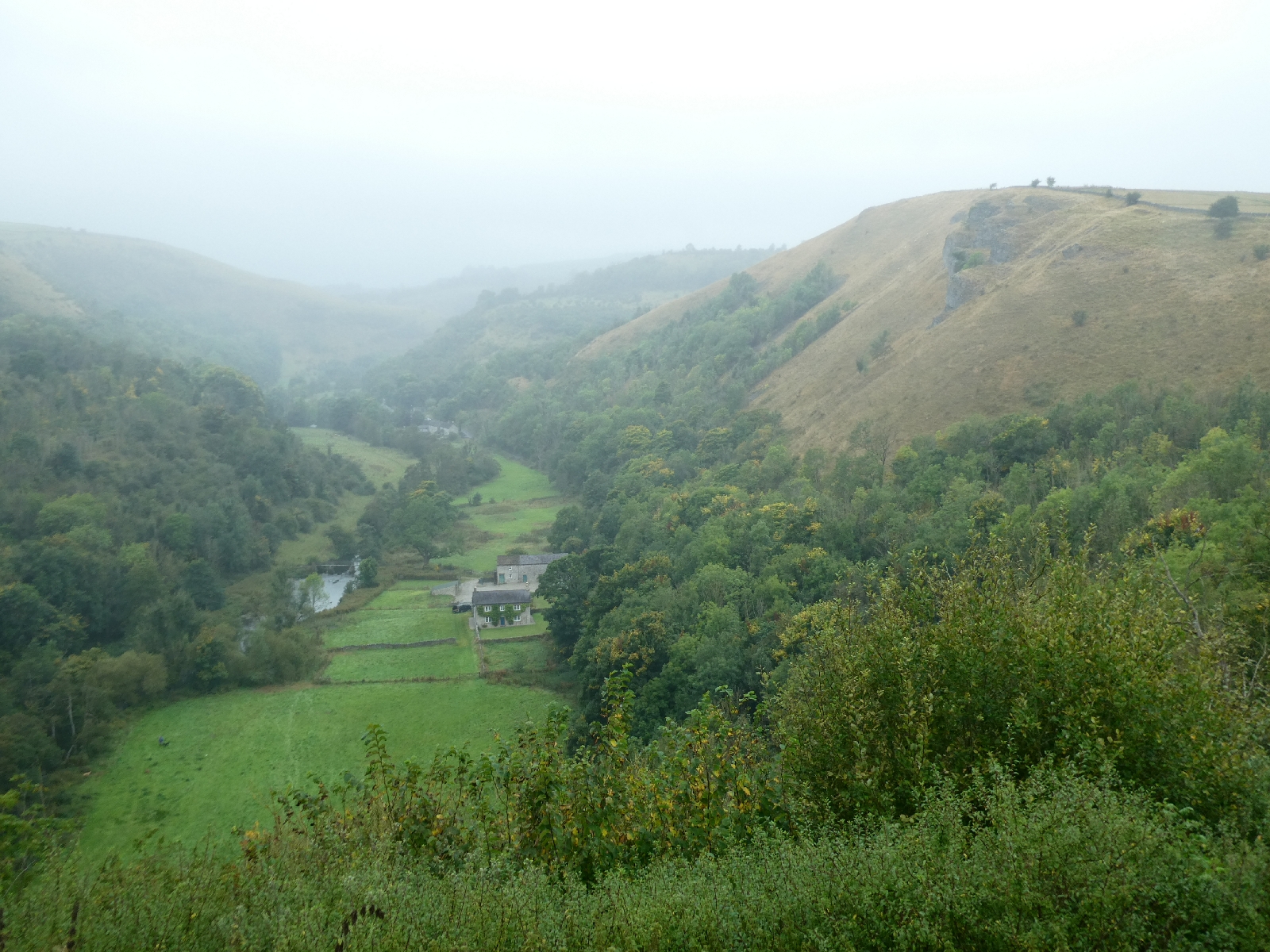
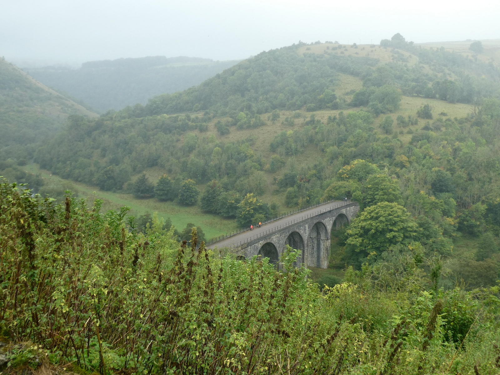
Things improved marginally on the climb up to Monsal Head, except for the mist. Monsal Head is a renowned viewpoint, looking down into Monsal Dale and the old railway viaduct which now forms part of the Monsal Trail, a walking and cycling route. It was all there, just very murky.
The greyness did not do much for the landmark Monsal Head hotel either, which looked like it could use at least a lick of paint.

I descended into the dale and followed the little road to Cressbrook Mill.
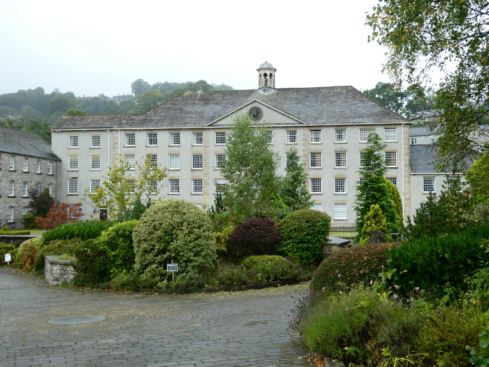
Cressbrook did not exist before 1762, then grew up around the cotton mill built originally by Richard Arkwright and later extended by McConnell. When the mill workforce objected to the quality of the housing, McConnell took it upon himself to build a model village, which today extends from the mill up a long and steep hill to the village centre and church at the top.
The mill went bust in 1965 and was falling into dereliction before being converted to apartments and posh holiday homes in the 2000s.
I climbed that long and relentless hill and rested by the little church, then putting waterproofs back on as the drizzle grew heavier.

I had abandoned plans to walk the length of Cressbrook Dale, partly because I wouldn't have seen much of it, partly because I didn't fancy almost three miles of wet slippery stony paths. Instead I followed a little road which crossed the tops to Litton. If only the weather had been better the views would have been really fine.


Litton is a neat village with a small green and a shop.

Another mile brought me to Tideswell, a large village dominated by a grand church, dedicated to St John the Baptist and nicknamed the "Cathedral of the Peak".


I sat to eat my lunch, fascinated by the way people seemed to dump their cars anywhere and head off to shop - it's not like that in London!
Just north of Tideswell, and another change of plan to avoid miles of field paths, I joined a little lane hopefully signposted "Castleton", still almost six miles away.
On this road things got a little serious. The drizzle intensified and the wind was quite vicious - it felt like late October, not the start of September.

The road eventually sets off in a long curved diversion around the edge of an enormous limestone quarry, the road is narrow but obviously quite new. The old direct line of the road is still discernible on the map. Here also the road rises, going up to over 1,300 feet, actually the highest point of my route so far. But I could see nothing of it. It was above today's very low cloud line, and for around 1½ miles visibility was less than 50 yards. I was passed by only one car. The experience of being up there alone in the mist was quite unusual.

As the road descended suddenly Castleton village came into view, as did the Hope cement works, an unfortunate Peak District landmark for decades.


Castleton is the classic Peakland hub, with more pubs per yard than most places I know, outdoor shops, and an abundance of grey stone.


Tomorrow is forecast to be quite different - sunny and warmer. But that's only a forecast.
Ah, ye of little faith... Today began grey, with mist on the tops, despite a forecast of sunshine all the way.
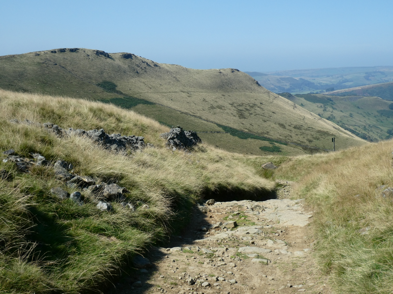
It was still grey and quite chilly when I set out to climb up to Hollins Cross, at about 1,300 feet the lowest crossing point in the ridge between Castleton and Edale, but by the time I'd hauled myself and my pack up the steep path to the top the sun was out and the mists were burning off fast.


The top of Mam Tor, up to the south, was more attractive suddenly than a steep scramble down to the valley (and a long and steep climb out of it) so I followed the ridge, along with quite a crowd of others.

The ridge from Lose Hill (the pointy one in the distance) to Mam Tor is
reputedly one of Britain's finest ridge walks. I remember it when the
path was rough and uneven, but now it's mostly paved to prevent more
erosion.
The views across to Edale and the south side of Kinder Scout were superb.


At 1,695 feet the top of Mam Tor set a new highest for this trek, and by a tiny margin the highest point on any of my treks so far.
I followed the road below the tor for a mile or two - this was a major road between Stockport and Sheffield until the section above Castleton finally collapsed beyond repair in 1979, but today it seemed busy even if it doesn't go anywhere much.
I turned off to join a track leading to Hayfield, part of the Pennine Bridleway, and listed as one of England's most notable lanes.

Lane? For that read mountain track, steep and stony with serious need for walking poles.

The Pennine Bridleway is a linear route from Derbyshire to Cumbria, completely different from the Pennine Way, and open to horse riders and mountain bikers as well as walkers. This section would have been for very experienced riders only.

The three miles or so took me much longer than I'd expected, but the views were simply amazing. It was also really windy, especially in the later stages around South Head, so apologies if any of the photos aren't quite straight.


There is a sharp and long descent from the high point at around 1,400 feet to Hayfield, perhaps a thousand feet lower.

Curiously Google Maps suggests walking from here to Glossop along the busy, and sometimes narrow main road. I did not do that. Instead I followed a little steep lane for about a mile, passed by a truck driver whose vehicle only just fitted the road. He muttered something about the "bloody satnav" as he squeezed by me. Then back to the Pennine Bridleway, which climbs relentlessly to the side of Lantern Pike, touching 1,100 feet before coming back down across fields (passing some handsome horned cows) and past isolated farms to rejoin the roads.

The high sections offered some fine views across to the lowering bulk of Kinder Scout, the long skyline in the picture.

At the road junction I opted for the easy but long and quite tedious option of following the road, eventually passing Charlesworth and wriggling down towards Simmondley and Glossop, with a good aerial view of the town during the descent.

It also offered another opportunity to be amused by driver behaviour. I walk, as the rules say, on the right hand side, facing oncoming traffic. Most drivers pull out enough to give me around 1½ metres, same as a cyclist, which is fine. A few seem intent on murder and swerve sharply at the last minute, or cut past me at less than a metre. You get to spot the type from a distance. There are those who pull right over to the far side of the road, as if they feared I might explode, and others who brake sharply on sight. All very entertaining.
A long day, mostly because of slow progress on difficult terrain, but a very satisfying one under blue skies.
I was getting tetchy. Firstly breakfast service in my
overnight place in Glossop didn't start until 9am, then there was nobody
in sight, finally the breakfast took ages to arrive....
By the time I set out I was almost an hour later than I usually like to be.
Not only that, but the return of damp greyness had persuaded me to
change my route, swapping a wander over the moors for a road route, with
less detailed knowledge of what lay ahead.
Oh well, one foot in front of the other.
I passed under the Dinting viaduct, originally built in 1842, but upgraded in the 1920s, to carry the single track Glossop railway line over the road to Manchester, today's A57.

Today that road, along with most I travelled, was very busy indeed, as part of the M62 trans-Pennine motorway is closed for the weekend, causing traffic to flood every possible alternative the satnav can find.

I walked on, passing through Mottram, with a few handsome old cottages, to Stalybridge, which once curiously belonged to Cheshire but is now within Greater Manchester. The sun emerged as I crossed the canal and then the River Tame.


Next came a steep climb then a long slog to Mossley, where I spotted a row of cottages where the satellite TV salesman obviously went from door to door...

It's a bit of a one-street town, but for me it marked the start of an ascent which would last a couple of hours, first steeply to quit the town, then more gradually, on and on, up and up.

The murky views confirmed I had been right not to risk the moors.

At Lydgate, high and exposed, I suddenly came upon the church of St Anne, built in the late 18th century but remodelled a hundred years later.

The climb continued, eventually following a tiny lane for about 1½ miles, which rose to almost 1,200 feet and lifted me into the damp drizzle of the cloud base.

Even here the satnav warriors were out in force, I doubt if that road has ever seen so many cars.
At the top, the Bishops Park monument, which marks the highest point in the borough of Oldham (1,233 feet) was visible for a moment then wholly buried in mist.
Just along from there a large house in the local stone style loomed out of the murk - Wuthering Heights anyone?

At Grains Bar, a junction of several roads, the descent finally began. I passed a large pub, also in that architectural style, then the road dipped out of the clouds and there was something to see.


Uphill, of course...


I left the shores of Hollingworth Lake, not so clearly visible, and continued to Littleborough, a town rather struggling to uncouple itself from nearby Rochdale.

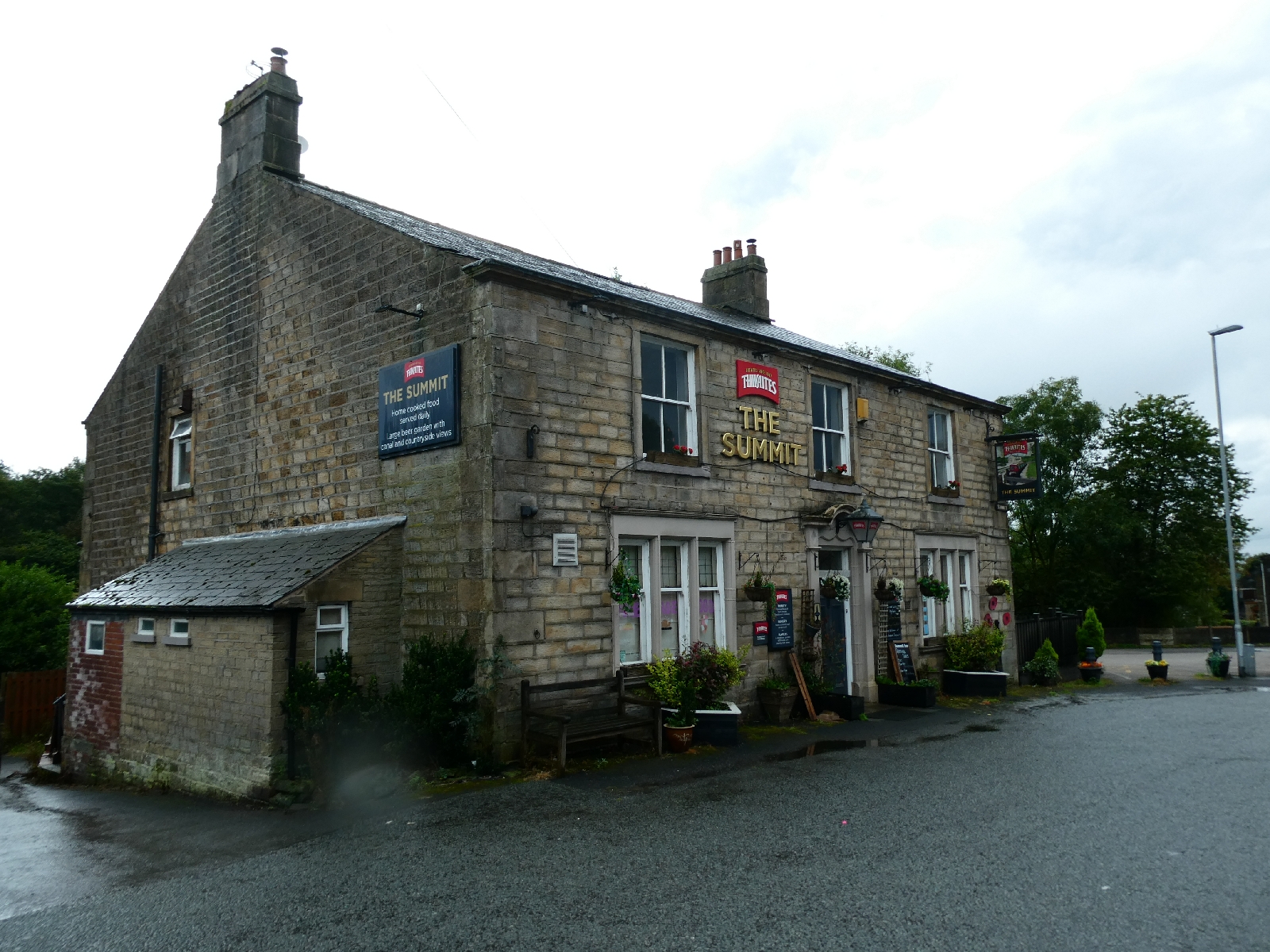
My plans had included sections of the Pennine Bridleway, going up for views and down again, but the soaking ground and constant risk of drizzle persuaded me to the main road, climbing gradually for a very long time to reach the aptly named hamlet of Summit.
The road then descends slightly, entering Yorkshire, through a steep little valley threaded by the Rochdale Canal, to the equally well named Bottomley, then on to the village of Walsden.

By now Todmorden had already announced itself - prematurely as there were still 1½ damp miles to go. It rained a little more heavily, but reverted to damp light drizzle by the time I reached the town.
Todmorden has a long history of social collaboration, not least through the Cooperative Society, founded in the early 19th century (but later than the renowned Rochdale Society, which was the first). One of the former stores is dressed in its original glory - it's now a health food café, so perhaps the founders would approve.

The town centre is all in Pennine stone, and includes a public market.


Again a change of plan, as I had intended to make a very long climb behind the town, then to follow a high moorland road towards Burnley. Not in this weather. I stuck to the main road down in the valley.
It's an enormous compliment to those who designed and who maintain these roads that they all have pavements. All the way. Walking a trunk road in most parts of the country would be almost suicidal, but here it's a comfortable way to cover distance. Other counties take note.
The road towards Burnley follows the upper Calder valley, which is narrow and steep-sided, uphill to Lydgate (my second "uphill to Lydgate" in two days) then uphill again to Cornholme.
This is mostly a one-street village, roads off tending to stop as the slopes shoot upwards. It's not lovely, but it has a strange feeling to it. Apparently because of its situation the sun never reaches the valley floor between November and March.


Todmorden has featured in many films and TV series - recently in "Happy Valley", while Cornholme fought back with a starring role in ITV's "Passenger".
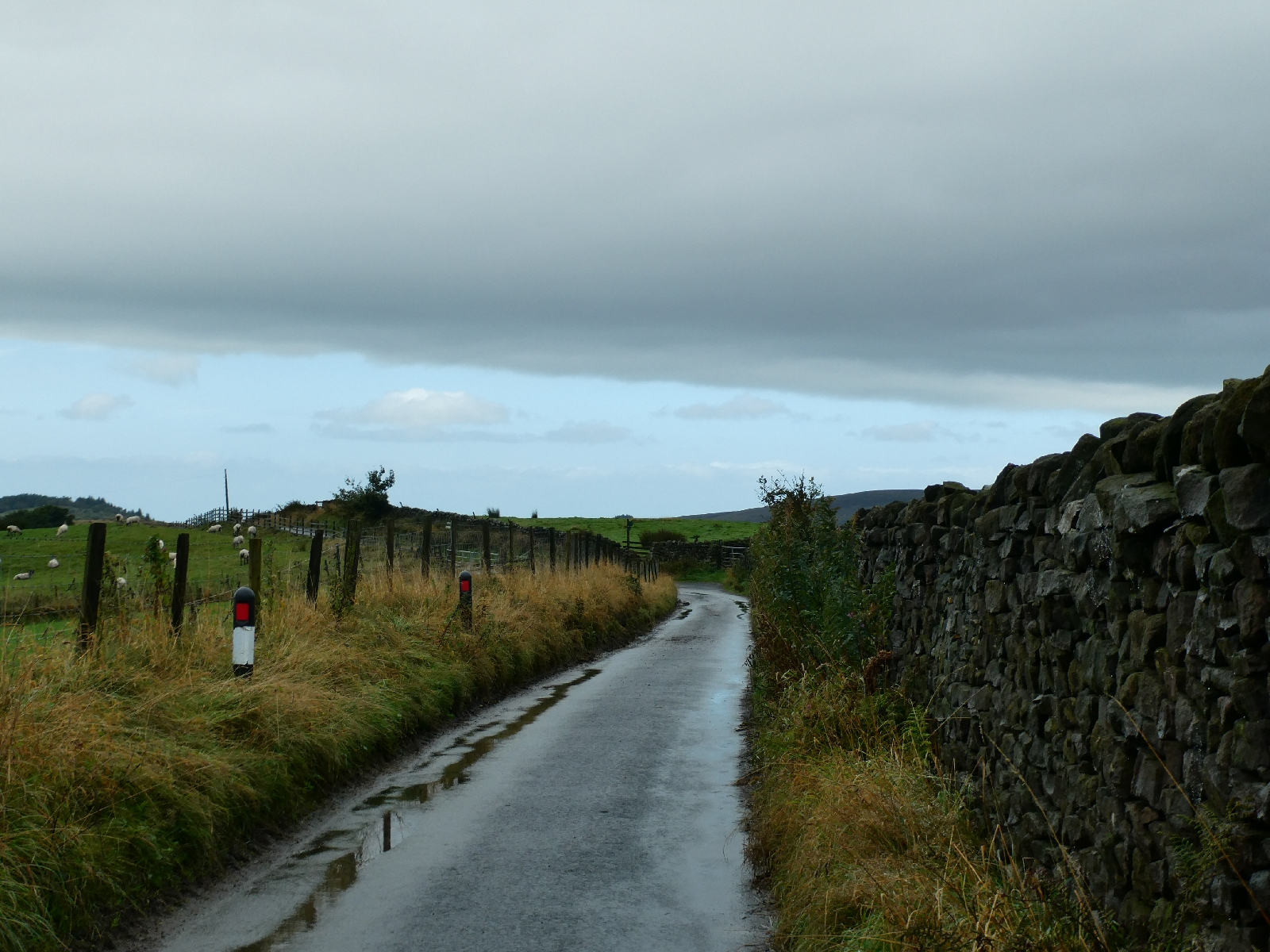
Just after the adjoining and very drab settlement of Portsmouth (no relation) the road re-enters Lancashire and pitches uphill again into more open country.


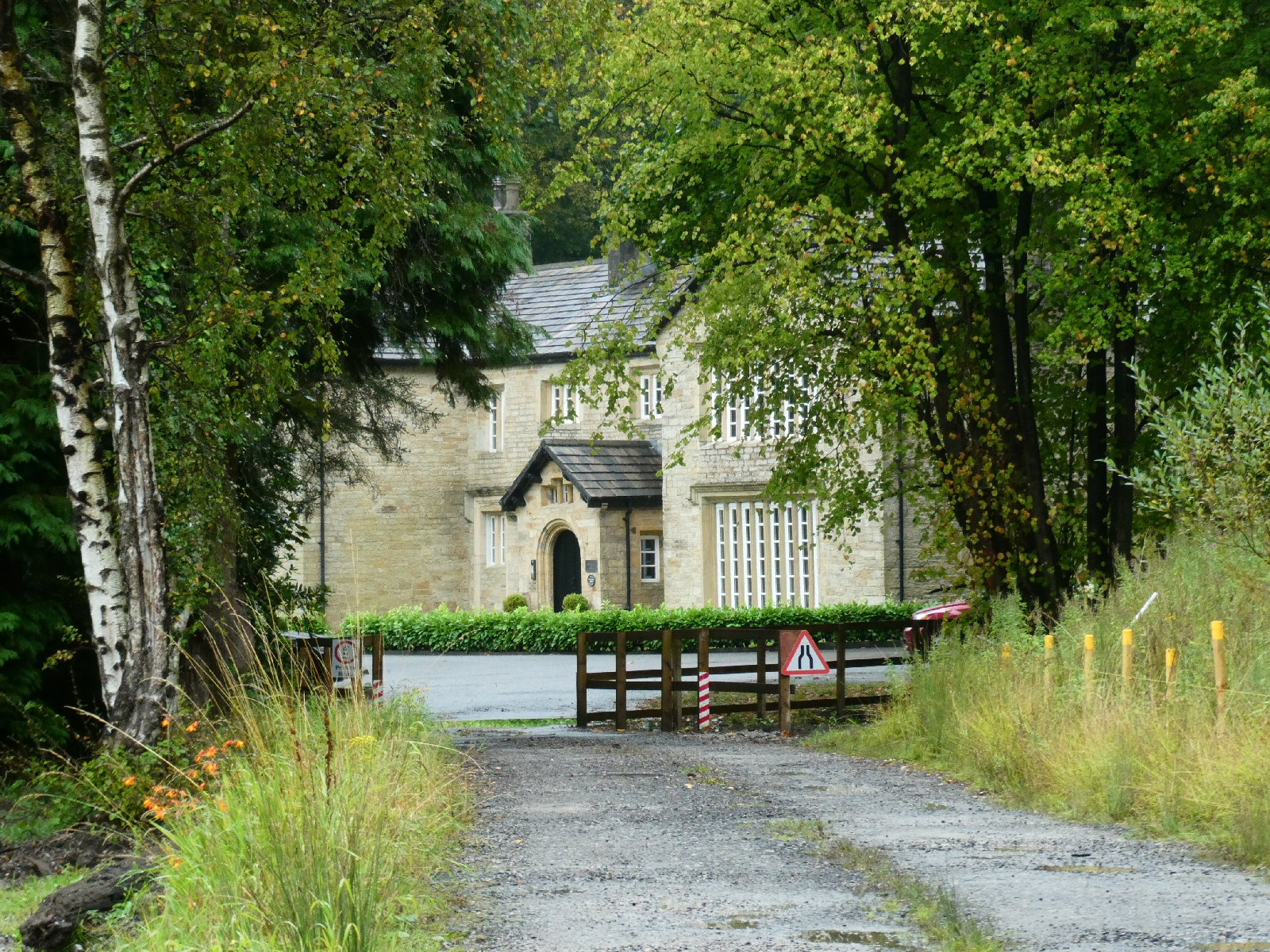
I paused by Holme Hall, a 17th century manor house, once a retirement home, then derelict for a decade, now inevitably converted into apartments.
Just down the road is Holme Chapel, a more pleasant and brighter little place with an ancient pub.

I'm still quite amazed how many functioning roadside pubs there are here in out of the way places, while thousands are closing elsewhere in the country - but then the price of a pint is more reasonable.
Beyond the village the drizzle intensified again, but now I was so close to Burnley and my budget bed for the night that I just slogged onward!

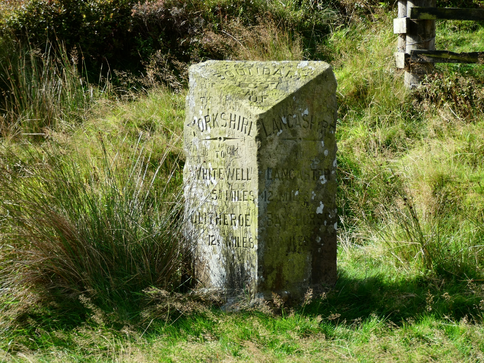
Tomorrow is expected to start grim but soon to brighten. I'm changing plans again though, as my suggested climb over Pendle Hill would be wet and unwise with a full pack after today's rain, so I shall divert towards Clitheroe instead. We shall see.


Day Ten - Tuesday 10th September - Whitewell to Lancaster
As I sat eating my breakfast just after 8am this morning
the rain came down in swirling curtains. With my faith in the forecast I
delayed setting out until just after 10, by which time only a few spots
of wetness remained.
The route plan to Lancaster was simple - I would follow the road all the
way, over the Forest of Bowland, about 40 minutes by car and just over
six hours on foot. The road would be a great scenic drive, but much more
is seen and gained by walking it.

In a couple of miles I reached Dunsop Bridge, with its decorous little church, like many in this area a Roman Catholic place of worship.

Lancashire has long been a stronghold of English Catholicism, second only to Liverpool and for much the same reasons.
The sun came out as I followed the narrowing road to Sykes, where the grind to the top of the Trough of Bowland begins. It's a steep and twisting climb to just over 1,000 feet, made more interesting today by a cold and fierce headwind.


From the milestone at the top the road drops quite rapidly, passing a long copse threaded by a stream, which today was pretty in the sunshine.


The road continues to the hamlet of Marshaw, then wriggles up and down for a couple of miles to Lower Lee.


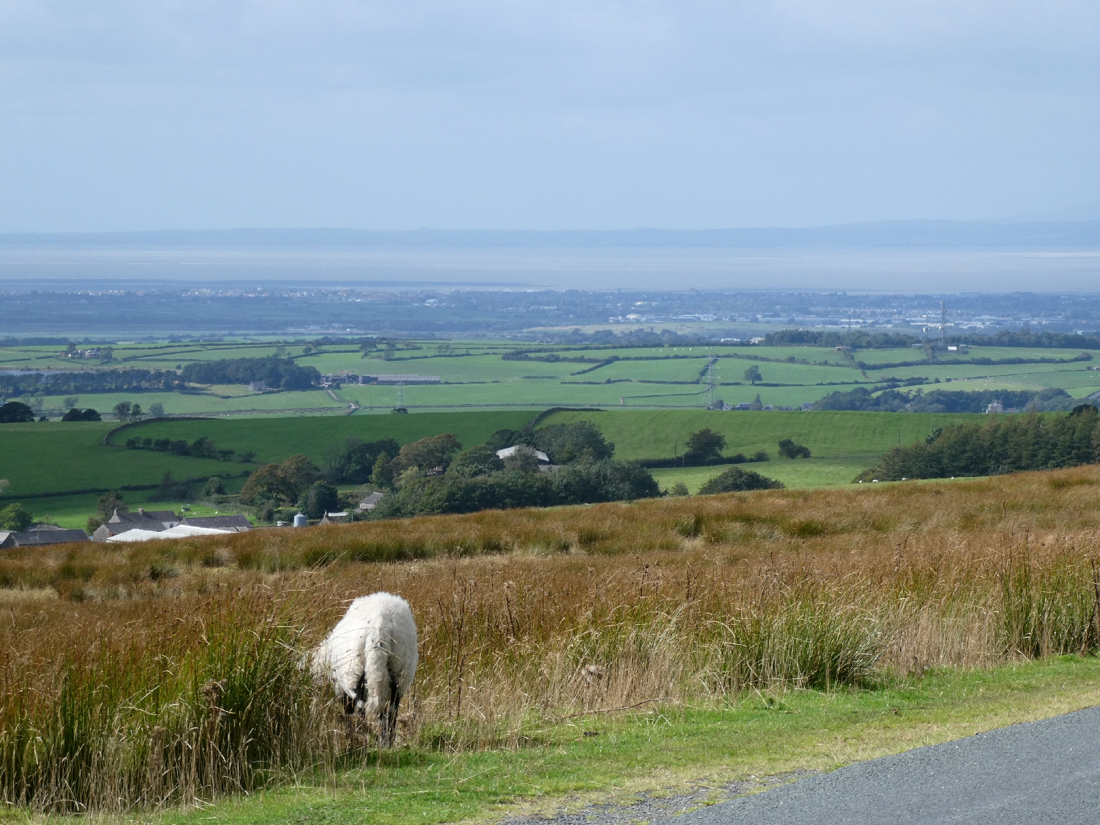
Here begins another climb, a couple of miles long, up over open moorland and into the teeth of that wind, to the Jubilee Tower, erected in 1887 by one James Harrison to mark Victoria's golden jubilee.


It stands at about 930 feet and offers stupendous views, not just back to the Bowland hills but west to Morecambe Bay, and the sweep of sand north of Blackpool. No doubt sometimes it's possible to see the tower!

There are steps to climb the four metres to the top, rather unwise in today's wind.
The descent from the tower is gradual at first, before taking a very straight dive towards the village of Quernmore.
Here I passed the most perfectly manicured chapel and graveyard I think I've ever seen, again a Roman Catholic place of worship.

And if I thought I was done with steep climbs, the zigzag rise to Conderdell had other ideas, but it did offer a last glimpse of Bowland.

The road descended from there to pass under the M6 motorway before reaching the edge of Lancaster. On the way in I passed Lancaster cathedral, once more Roman Catholic, built in the 19th century and almost impossible to photograph. It sits next to a tree-lined road and has a 270ft spire. But here I had joined two cathedrals together, Lichfield and Lancaster, mission accomplished.

Lancaster is a city of grey stone, with all the usual shops available, quite an attractive place, if tonight very busy with traffic.

This is journey's end, I'm guessing about 157-158
miles, much to work out when I return home - which is due to happen
with a morning train to London tomorrow, back to Euston where the
adventure began.
Afterthoughts from the journey of 2024

Back in London now, and - a few days on from a jumbled journey from Lancaster on the West Coast main line – time to consider.
This year’s walk was doubly unusual, in that it did not start or end anywhere near home, and it did not follow any defined trail or prescribed route. It was almost exactly the same length as last year’s jaunt from Winchester to Canterbury, but through very different and varied landscapes, and with more ups and downs.
From the daily entries it is no secret that the weather played a big part this time, causing some significant changes of plan, and keeping me quite often on low roads rather than high paths, both for navigation and for safety.
Of the nine actual trekking days, the total mileage was a fraction short of 161, an average of just under 18 miles per day, with 17,000 feet of ascent and descent. That was only about three miles less than the original plan, but with significantly less – about 4,000 feet – ups and downs.
In retrospect it was a good walk with huge variety in landscape and environment, with some superb days, and some not so good.

On the equipment front there was little change from previous journeys – my trusty Osprey Aether 65 backpack paired with Merrell Moab 3 walking shoes – this year in a fetching grey with blue trim – Smartwool socks and Berghaus Paclite very lightweight jacket and overtrousers, which this time worked really hard. There was one addition – a pair of Kahtoola ankle gaiters. They are designed to keep small stones and muck out of walking shoes, but I found they also prevented rainwater leeching from overtrousers to socks, and thus kept my feet dry in the wettest conditions. Not cheap, but well worth it!
No comments:
Post a Comment