The forecast for today threatened high temperatures, 27-29 degrees with quite high humidity, which might not sound much for some parts of the world but it's significant with a loaded pack, 17 miles and a tough day for ups and downs.
A mile or so of level walking brought me to the first climb back up towards the downland ridge.

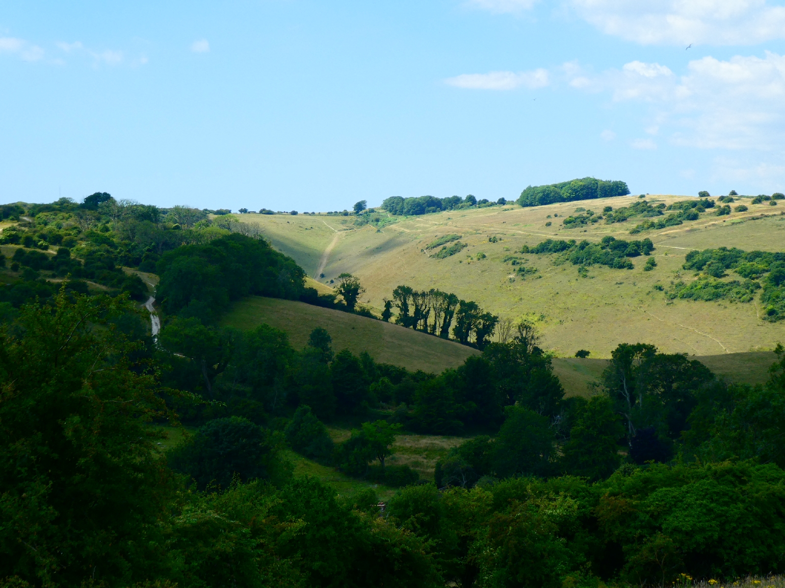
That was a long perspiring trudge but rewarded with good views stretching back to Chanctonbury Ring.

The uphill continued on a little lane, leading to Truleigh Hill Youth Hostel.
There aren't so many of those left. The first time I walked the South Downs, aged just 17, with a schoolfriend, we travelled from hostel to hostel, slept in bunks and couldn't leave without having done some chore or other. Truleigh Hill looked more like a B&B with a café and - heaven forbid in the past - a car park.
Truleigh Hill is a landmark only for its radio telecomms masts.

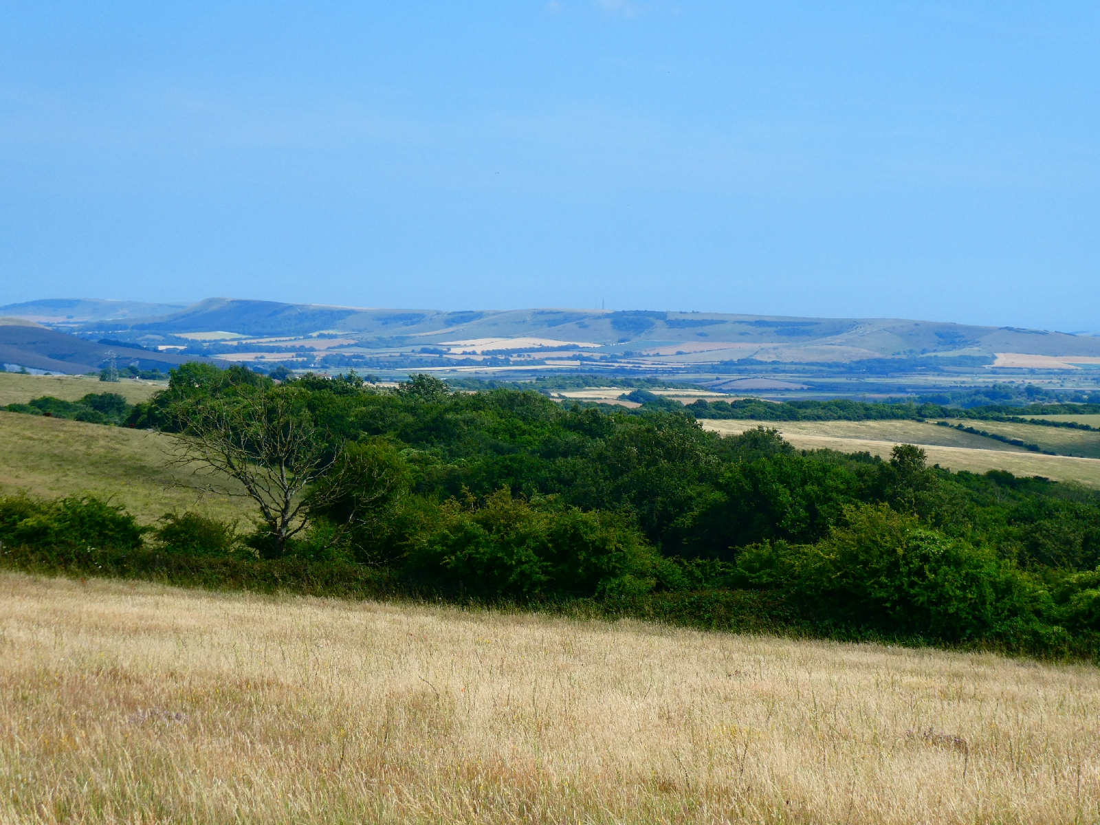
The path descends to a viewpoint overlooking the steep escarpment, then switchbacks over a series of hilltops - Edburton Hill, Perching Hill, Fulking Hill - always with superb views north to the landscape below.


It's possible to become blasé about such amazing views when they're there all the time.
Luckily there was a breeze coming up from the sea, also always in view to the south, so the temperature was bearable.
Things got busier approaching the Devil's Dyke, although most were heading for the pub, the café the car park, while the South Downs Way steers clear and passes along the dyke's southern edge.
The Devil's Dyke is a natural steep combe in the chalk hills, a well known visitor attraction since Victorian times, not least because it is close to Brighton, whose tall buildings and seafront tower are visible from the trail.

The route then descends steeply to the hamlet of Saddlescombe, before going straight back up again to the top of Newtimber Hill, regaining every foot of altitude. In compensation there is a fine view back into the Devil's Dyke.
What goes up on this route must go down again, all the way down to Pyecombe, and a bridge to cross the noisy and busy A23 dual carriageway rushing down to Brighton.
And then of course back uphill again, through the local golf course - which must be quite energising - before turning to regain the ridge top.

Here I was close to another landmark - a pair of windmills known as Jack and Jill, or the Clayton Windmills. Jack dates from the 1860s, Jill is around thirty years older and occasionally open to the public.
Both, however, were some way off the route, and downhill, so I left that diversion to one side and continued the stony slog back up to 750 feet, and the point where I crossed from West Sussex to East Sussex, the last of five counties on this journey.

The path turned grassy and very pleasant for the next half mile, shared with sheep who seemed more interested in finding any shade they could.

Next came Ditchling Beacon, another well-known landmark, and - unusually for downland hills - marked by a trig point. At 813 feet, one of the highest tops on these hills, perhaps it deserves it.

I remember from decades ago that the small car park on the road below the top used to be blessed with an ice cream van. So it was today....
From here the path once more goes uphill and downhill, passing Plumpton Plain, before turning south.


No comments:
Post a Comment